‘Polar Vortex’ to Return Across the US This Week, Federal Agency Warns


Winter storm warnings were in effect Wednesday across the western United States.

As more winter storm warnings and advisories are under effect across the western United States on Wednesday, a National Weather Service (NWS) official advised what Americans should do if they’re ever caught in a blizzard.

But starting this weekend, icy cold air from the Arctic will start to spread across the middle of the United States and will continue into the next week, said the NWS’s Weather Prediction Center in a post on Tuesday.

The agency said, “Much below normal temperatures along with gusty winds will lead to wind chills well below zero for many locations.”

According to a map posted by the weather service, when factoring in wind chill, temperatures could reach minus-60 degrees Fahrenheit in parts of North Dakota, Montana, and possibly Idaho.

Separately, it warned snow-struck regions of the Midwest and the Great Plains that temperatures could plunge dangerously low, dipping to around minus 20, and even far lower in Chicago and Kansas City.

Private forecasters including AccuWeather made similar predictions for the weekend and next week, with AccuWeather describing it as the “coldest weather so far” this season. “This outbreak of cold air will rival the arctic air mass right before Christmas 2022,” AccuWeather forecaster Tom Kines said.

The severe cold could put pressure on energy demands in the Southern United States, forecasters warned. In parts of Texas and Oklahoma, temperatures may drop to below zero Fahrenheit at night.

“The stratospheric polar vortex is now stretching down across North America,” NOAA scientist Amy Butler wrote on Tuesday afternoon. “That polar jet will be pushed further south, and guess what that does? It opens up the freezer door,” said Fox Weather Meteorologist Kendall Smith, who added: “All of that cold, arctic air that has been bottled up right over Canada, right over the Arctic, is going to be blasting its way right into the Lower 48.”

The Arctic about two weeks ago underwent a stratospheric warming, which slowed the polar vortex winds, said Ms. Butler in an article.

Temperatures for the 2024 Iowa caucuses on Monday, Jan. 22, will be close to zero degrees across much of the state, said the NWS in Des Moines. “Now is the time to check your car batteries, they will be flying off the shelves next week,” the weather service said.

Storms Persist

It came as a major storm drenched the Northeast and slammed it with fierce winds, knocking out power to hundreds of thousands following a bout of violent weather that struck most of the country. That followed a day of tornadoes and deadly accidents in the South and blizzards in the Midwest and Northwest. In some parts of the Pacific Northwest and the Rockies, more than two feet of snow fell.

The storm, which began Monday, buried cities across the Midwest in snow, stranding people on highways. Some areas saw up to a foot (30 centimeters) of snow on Monday, including Kansas, eastern Nebraska and South Dakota, western Iowa, and southwestern Minnesota. Madison, Wisconsin, was under a winter storm warning until early Wednesday, with as much as 9 inches of snow and 40 mph winds occurring.

In a bulletin on Wednesday, the NWS said that a “combination of heavy snow and strong winds will create blizzard conditions at times in parts of the Northwest through this afternoon, and storm total snow accumulations may reach several feet in the higher elevations of the Cascades and Olympics,” referring to the mountain ranges. “ Low visibility will make travel conditions particularly hazardous for many of the mountain passes.”
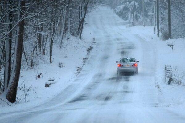
A car treks down a snow-covered road in Derry, N.H., on Jan. 7, 2024. (Charles Krupa/AP Photo)

Storms in the Pacific Northwest and Rocky Mountains dumped snow, including 29 inches at Stevens Pass in Washington and 30 inches outside Santa Fe, New Mexico, according to the NWS.

Authorities issued warnings for very dangerous avalanche conditions in mountainous areas of Idaho, Montana, Wyoming, Utah, Washington, and Oregon. Backcountry travelers were advised to stay off steep slopes and away from the bottom of steep slopes.

“So we were pretty lucky for a good chunk of the month of December and even into the very beginnings of January, but now it’s been a kind of page turn, if you will, a complete flip of the script,” Mr. Smith, the Fox Weather forecaster, noted. “Because now we’re starting to see that cold air that has been locked in place over Canada and over the Arctic. That’s going to be starting to change.”

Here’s All You Need To Know About The Polar Vortex Coming Through Next Week.


The first polar vortex blast is ready to chill the residents close to the Arctic to their bones. Temperatures have already started dipping below minus 0 degrees across the northern plains of America. And it is only going to get worse…

Polar Vortex

The polar vortex is not a new phenomenon. It is actually active all through the year but comes to “life” in the winters. The term became popular in 2014 and refers to a very large, extremely cold air mass over the Arctic. The concentrated area of cold air is bound by the jet stream, which is a current of fast-moving air at very high levels of the atmosphere. When the jet stream is strong and keeps the polar vortex area bottled up north, temperatures can fall to minus-100 degrees.

 The reason it becomes even more active in winters as the Artic air become colder for the lack of sunlight and as the Earth shifts on its axis, the air plunges south.

The most well-recorded cold-air outbreaks in the past 30 years were caused by the polar vortex diving south.

Polar Vortex

VERY WEATHER

This year, the weather departments across the northernmost countries suggest that temperatures will record 20 to 35 degrees below the average temperatures recorded at this time of the year.

Washington and Boston will also see freezing temperatures through the daytime, as will most of New England.

The polar vortex is coming. Here’s what that means — and how cold it could get.


Winter’s first polar vortex blast, already taking shape in the Arctic this weekend, targets the Lower 48 next week. By Tuesday, temperatures below zero will plunge south into the northern plains and Midwest. Over the course of a few days, the cold air will blast across the country to the Northeast.

The northern tier has already seen a taste of what this winter has to offer — in fact, the region is already experiencing a significant cold snap. On Thursday morning, the temperature in Billings, Mont., dropped to minus-3. It was the first time the location saw a temperature below zero in 698 days, since Jan. 9, 2015. Almost the entire state of North Dakota is under a wind chill advisory — the National Weather Service is calling for temperatures that feel like minus-35.

Next week’s cold blast will dive farther south and east.

Weather forecast models are suggesting temperatures will nose-dive in the Midwest. All of Minnesota and Wisconsin — plus the Chicagoland area — could see overnight lows plummet into negative territory: minus-15 in Minneapolis, minus-10 in Milwaukee and minus-5 in the Chicagoland area around Wednesday or Thursday.

The forecast is 20 to 35 degrees below average for this time of year.

What will likely be the coldest air since last February will barge into the Mid-Atlantic and Northeast late next week. Daytime temperatures from Washington to Boston will struggle to climb above freezing. Overnight lows will surely be in the single digits and teens, if not below zero in parts of New England.

Through Thursday, 75 percent of the Lower 48 will have experienced a temperature below freezing, including Texas, the Deep South and the Pacific Northwest, based on National Weather Service forecasts.

The frigid air tied up in this polar vortex blast has its origins in Siberia and northern Canada. It will be the coldest air of the season so far for most of the United States. Future cold blasts may be more potent, but we haven’t experienced this since last February.

The polar vortex is not a new thing — it’s a weather term that was popularized in 2014, though it’s always been something meteorologists knew of and referred to among themselves.

It’s a very large, extremely cold air mass over the Arctic (the Antarctic has one, too). The concentrated area of cold air is bound by the jet stream, which is a current of fast-moving air at very high levels of the atmosphere. When the jet stream is strong and keeps the polar vortex area bottled up north, temperatures can fall to minus-100 degrees.

The vortex is always present — even in the summer. But winter is when it really comes alive — not only is Arctic air colder because of the lack of sunlight, this is also when the jet stream plunges south. When that happens, it allows the cold air to spill south, like a freezer with the door left open.

Some of the most historic cold-air outbreaks of the past 30 years have been caused by the polar vortex diving south.

The Return of the Polar Vortex Is Actually a Good Thing.


Just when you thought it was safe to go outside again, the polar vortex is back, blasting the Midwest and eastern half of the U.S with very cold weather. While this will undoubtedly be unpleasant, there is an upside.

You might remember the polar vortex from January and later in January, when it brought extremely low temperatures to a good deal of North America. Starting next week the atmospheric phenomenon, usually confined to the Arctic regions of our planet, will be dipping down once again into many states.

1911995_10152211847766772_1441833266_n

Models are “very confident that it’ll be significantly colder than average” in much of the eastern two-thirds of the nation, said Mike Halpert, acting director at NOAA’s Climate Prediction Center. During the worst parts, temperatures could be as much as 20 to 35 degrees below average. The most affected areas will likely be places that have already felt the freeze this year, such as Minnesota, Wisconsin, and the Dakotas.

Those states are currently feeling a little relief as the weather has momentarily cleared up in the Midwest, leading to warmer temperatures in the 50s and 60s and heavy rain instead of snow. Though it might be a nice break from the freezing temperatures, unfortunately, this is actually a bad thing.

According to Weather Underground, there is so much snowpack on the frozen ground in the central and northeastern U.S. that warm weather and rain could lead to flash floods. Ice flows breaking up in rivers could also get carried downstream and jam up the flow, leading to spillover. It seems that the expected arrival of the polar vortex next week may be a blessing: The return of freezing temperatures could save the region from the worst of this.

“This week’s thaw will be short-lived, preventing the kind of major flooding that would result if all of the snowpack were to melt in a week,” wrote meteorologist Jeff Masters at Weather Underground.

The polar vortex originates in the far north, where sunlight has disappeared during the winter season, creating the Northern Hemisphere’s coldest air. Moving southward, this air gradually warms, until it reaches a place where the warming occurs very quickly. A swift-moving river of air moves west to east here, marking the typical southern edge of the polar vortex.

Another climactic phenomenon in play is known as the Arctic Oscillation, where atmospheric mass moves back and forth over many years between the Arctic and the middle latitudes. During a positive Arctic Oscillation, pressure is lower than normal over the Arctic but higher than normal over the mid-latitudes. Because air moves from high to low pressure, the polar vortex is pushed upward, nearer to the pole, creating warm weather in the Arctic Circle.

During a negative phase, conditions are reversed, with high pressure in the Arctic and low pressure in the mid-latitudes. This is the time when the polar vortex can develop waves or kinks that bring freezing air southward. Interestingly, this year’s Arctic Oscillation was not largely negative. This could help explain why the polar vortex only came down in North America and eastern Siberia. Other locations around and within the Arctic Circle such as Alaska, Scandinavia, Europe, and western Russia had much balmier than normal temperatures. While this year’s Arctic Oscillation wasn’t very negative, scientists have noticed a trend in recent decades toward more negative phases. Some blame loss of sea ice and other effects from climate change, though the true cause remains unclear.

Though many folks like to think this perpetually dark and frozen winter they are suffering through is especially miserable, it’s actually not been a particularly severe one when taking a long-term view of the entire country.

“People are saying this winter’s been really cold,” said Halpert. “When looking at the last three months, yeah, we’ll be a little on the cold side compared to average. But it’s certainly nothing historic.”

Just how cold it is, of course, depends on where you are. While some states, like Wisconsin, are experiencing what may be in the top five or 10 coldest winters on record, California is in the middle of a warm and dry drought. But a lot of the U.S. hasn’t been having anything really out of the ordinary weather-wise.

What Is This “Polar Vortex” That Is Freezing the U.S.?


As I write these words, temperatures across half the U.S. are plummeting like a rock.Extreme lows are forecast by tonight: -32 degrees Fahrenheit in Fargo, N.D.; -21 degrees F in Madison, Wisc.; -15 degrees F in Chicago and Indianapolis, according to the National Weather Service. Wind chills will reach a bizarre 60 degrees below zero F in some places, freezing exposed skin within one minute. That number is more typical for Mars—at night, according to the Curiosity rover NASA has free-wheeling over there.

As each hour passes, more and more television and radio reporters are attributing the insane cold to a “polar vortex” up in northern Canada. Vortex, yes, but upper Canada? Not exactly. One forecaster called the beast a hurricane in the Arctic, which is dramatic but wrong. So what is this mysterious marvel and why is it invading America?

The polar vortex is a prevailing wind pattern that circles the Arctic, flowing from west to east all the way around the Earth. It normally keeps extremely cold air bottled up toward the North Pole. Occasionally, though, the vortex weakens, allowing the cold air to pour down across Canada into the U.S., or down into other regions such Eastern Europe. In addition to bringing cold, the air mass can push the jet stream—the band of wind that typically flows from the Pacific Ocean across the U.S.—much further south as well. If the jet stream puts up a fight, the moisture it carries can fall out as heavy snow, which atmospheric scientists say is the circumstance that caused the February 2010 “snowmageddon” storm that shut down Washington, D.C.

But why does the vortex weaken? Now it gets interesting. More and more Arctic sea ice is melting during summer months. The more ice that melts, the more the Arctic Ocean warms. The ocean radiates much of that excess heat back to the atmosphere in winter, which disrupts the polar vortex. Data taken over the past decade indicate that when a lot of Arctic sea ice disappears in the summer, the vortex has a tendency to weaken over the subsequent winter, if related atmospheric conditions prevail over the northern Atlantic Ocean. The situation looks something like that shown in the graphic below. (For a full explanation, see the Scientific American article that accompanies the graphic.)

Although the extent of summer sea ice in the Arctic varies year to year, overall it has been disappearing to a notable degree since 2007 and it is forecast to continue to vanish even further. That could mean more trouble for the polar vortex, and more frigid outbreaks—a seeming contradiction to “global warming,” perhaps, but not for “global weirding,” also known as climate change.


What is a polar vortex?


The bitter chill gripping North America is a result of Arctic air that has spilled southwards, and global warming may be a cause, an expert has said.
Arctic air is normally penned in at the roof of the world by a powerful circular wind called the polar vortex, said Dim Coumou, a senior scientist at the Potsdam Institute for Climate Impact Research (PIK) near Berlin.

When the vortex weakens, the air starts heading southwards, bringing exceptional snow and chill to middle latitudes.

The weather shift is also helped by changes in a high altitude wind called the jet stream.

This convection, which usually encircles the northern hemisphere in a robust and predictable fashion, starts to zigzag, creating loops of extremely cold weather or unseasonably mild weather, depending on the location.

“We’ve seen a strong meandering of the jetstream, and the cold air associated with the polar vortex has been moving southwards, and in this case over the eastern parts of Canada and the United States, bringing this extreme cold weather,” said Coumou.

The phenomenon has occurred repeatedly in recent winters, he noted.

What drives the polar vortex is the difference in temperature between the Arctic and mid latitudes, said Coumou.

Once sharp, this differential has blurred in recent years as the Arctic — where temperatures are rising at about twice the global average — warms up, he said.

“We’ve seen this type of cold spell more often lately in recent winters, in Europe but also in the US,” Coumou said in a phone interview.

“The reason why we see these strong meanderings is still not fully settled, but it’s clear that the Arctic has been warming very rapidly. We have good data on this. Arctic temperatures have risen much more than other parts of the globe.”

Last month, European scientists reported that the volume of sea ice in November was around 50 percent greater compared with a year earlier, following a recovery in the Arctic summer.

Despite this bounce-back, sea ice remains at near-record documented lows and its overall trend is one of retreat, they said.

Coumou cautioned that Arctic sea ice “is just one of the important factors” behind disruption of the polar vortex”.

“Other factors include snow cover, stratospheric warming events or other short-lived phenomena,” he said.

Other specialists said the link between warming and the spillover of Arctic air was still debated.

“There is no consensus,” said Francois Gourand, a forecaster at Meteo France, the French national meteorological agency.

“The melting of sea ice can have an impact on atmospheric circulation but these effects are complex and hard to pin down,” he said.

“The overall trend of the sea ice is downwards, yet in Europe we can have mild winters sometimes, or cold winters — there doesn’t seem to be a clear link.”